Nasty Shasty (Mt. Shasta 05/2016)

I first put on skis when I was seven years old. My mom took me to a local Connecticut hill and since then it has been a persistent passion in my life. Learning how to ski on resorts, I progressed from mastering blues, diamonds and then in my teenage years double diamonds. Later I learned of the joy of tree skiing, first in Vermont and then in Colorado and then for more adventure with lift access hike-to terrain. Every year I find a desire to push myself and this has lead me to pursue the next logical conclusion in taking up a back-country ski mountaineering trip.

Life as a Philadelphia physician does not afford the time to put in fifty ski days a year. I am usually limited to one or two trips per winter. But I do my best to work with what I am given and have learned that you can extend the ski season until the spring if you search in the right places.

Last year, I skied Tuckerman’s Ravine, below the peak of Mount Washington in New Hampshire, at the end of April. This year I took my exploration of spring ski mountaineering West and set out to tackle Mount Shasta.

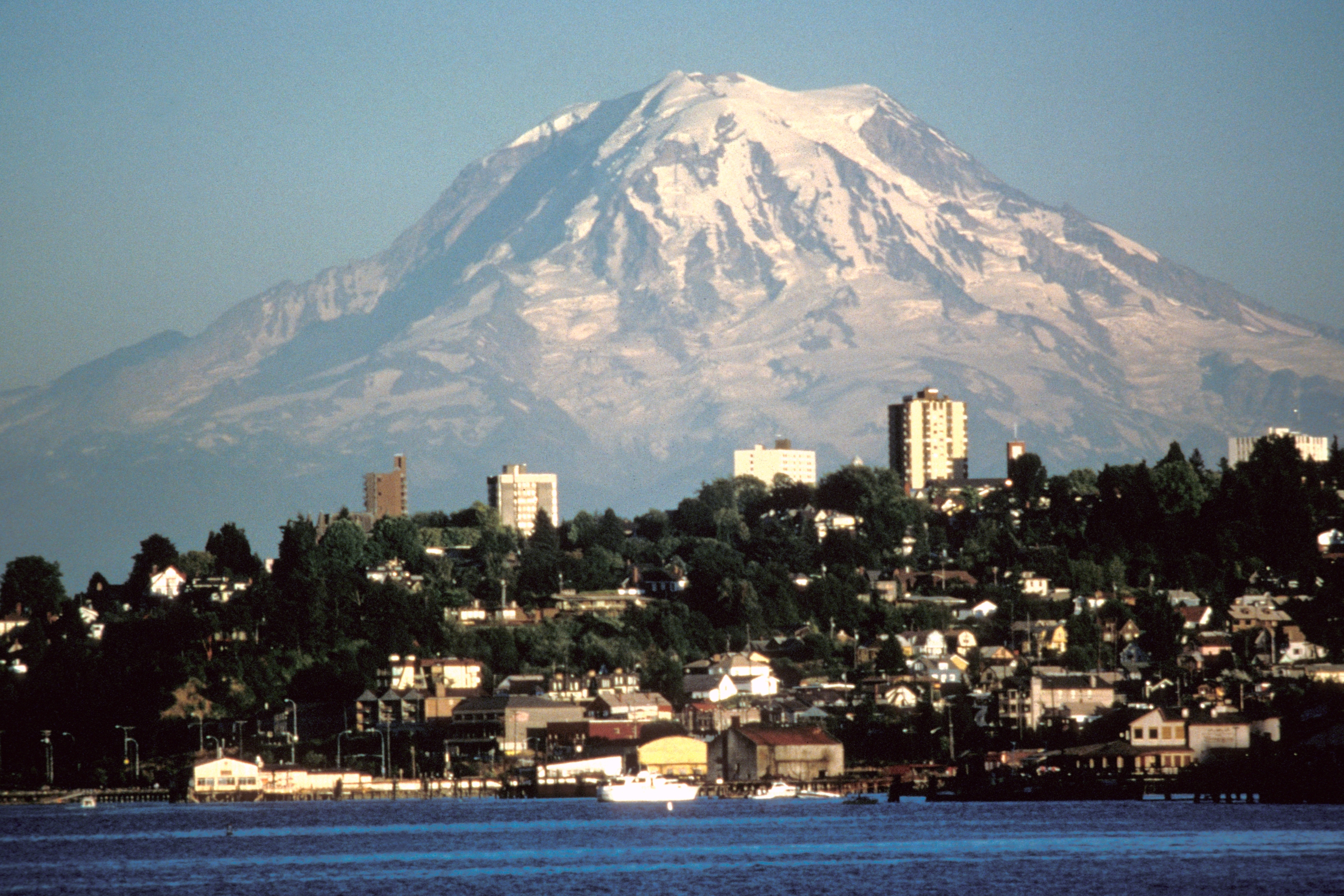
Mount Shasta is a a 14,180 foot active, glaciated volcano in the southern Cascade mountain range in Northern California. It holds the reputation as being one of the ultimate ski mountaineering destinations.

I flew to Sacramento, rented a car, a drove up interstate 5. The first 60 minutes of the drive  is a boring rural flat landscape until Shasta pierces the horizon and comes clearer and clearer view for the drive.

In Shasta, I stayed in a motel. The downtown was lonely and quiet and I was surprised to find everything closed by 6pm on a Friday night. It seemed that every other store sold crystals and other spiritual amulets. Dreadlocks grew freely from the heads of the townspeople like corn waving in the breeze in Iowa. There was certainly a strong vibe in the area.

On the day of preparing my car for the trek, I was parked next to a retired couple from Oklahoma. Friendly yes, the wife had a big smile on her face, as she wore a 1995 pink track suite and an Amish style hair bun, but I was trying to get my mind right and focused for the adventure. We talked for some minutes as I tried my hardest to be polite. At the end of the conversation she wished me best of luck and that she hoped I would run into the inter-dimensional beings. I looked at her confused. “Oh you didn’t know?” she explained, “the legends say a super human race lives in the center of the mountain of Shasta and spiritual seekers pilgrimage here year round as we try to learn how to live in harmony with them.”

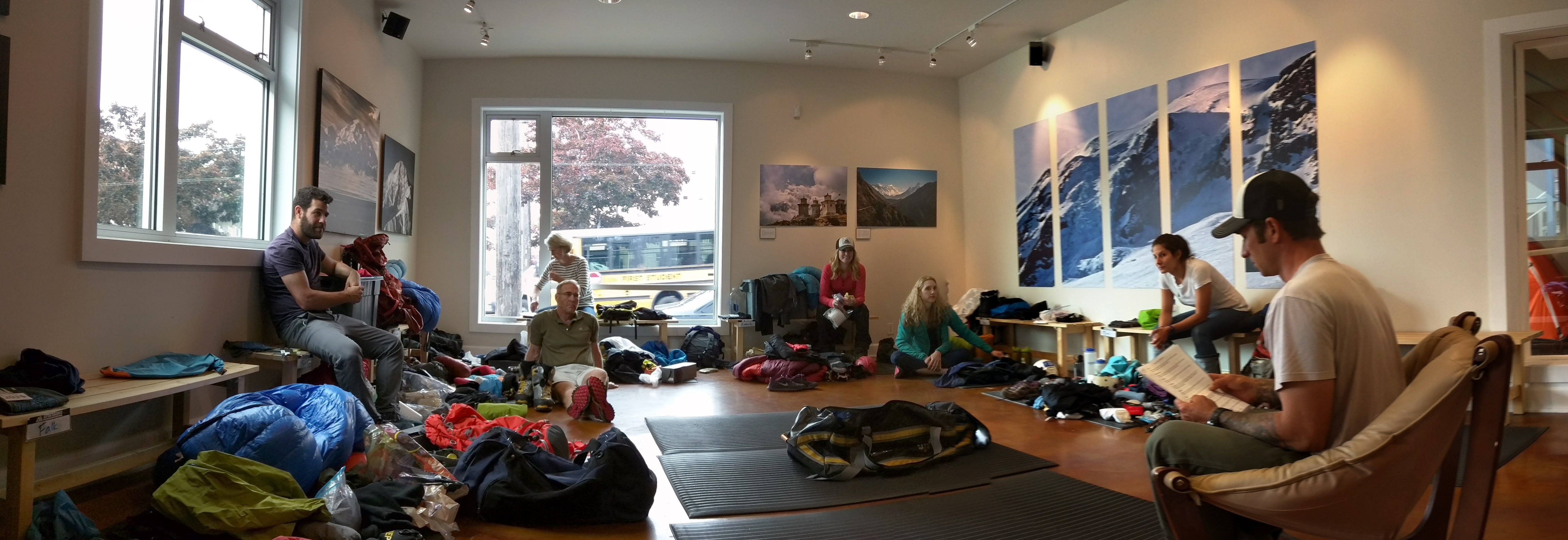
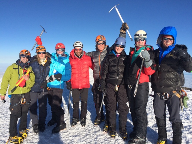
I had signed up to for a three day, two night ski trip with Shasta Mountain Guides. The small group consisted of myself with two other clients and two guides. We had very personal service and we were a tight group and we were prepared to communicate with any mountain spirits if needed (unless they were white walkers).

We left the parking lot near Bunny Flat Trailhead (6940′)and with skis on our boots, we skinned up the tracks to establish our tent near Horse camp (7,900′). As a beginner into randonee skiing or ski touring, I had to learn quickly about walking with my heal released from the bindings like a cross country skier and use “skins” which is a friction surface at the base which enables me to walk up the mountain on skis.

It was actually quite easy. After establishing our base camp at 8000 feet elevation, we then would skin up to variousgetting ready portions of the mountain and then lock in our heals and alpine ski down in the soft warmed up corn snow. Turns just feel like you are spreading butter on a fresh baked bread.

Ski mountaineering is a challenge of terrain and weather. The snow is at the mercy of the course of the sun. It is icy and unforgiving at night and in cold cloud cover, then when baking in the blue skies the surface softens and promises pristine turns. The extremes of temperatures change in the matter of minutes. At one moment a gust of wind will blow clouds through and induce us to bundle up up to our ski parka, and in a short while, it will clear out and heat up forcing all mountaineers to shed layers quickly or fog your glacier glasses and soak your shirt from sweat (which will later on freeze when it gets cold again).

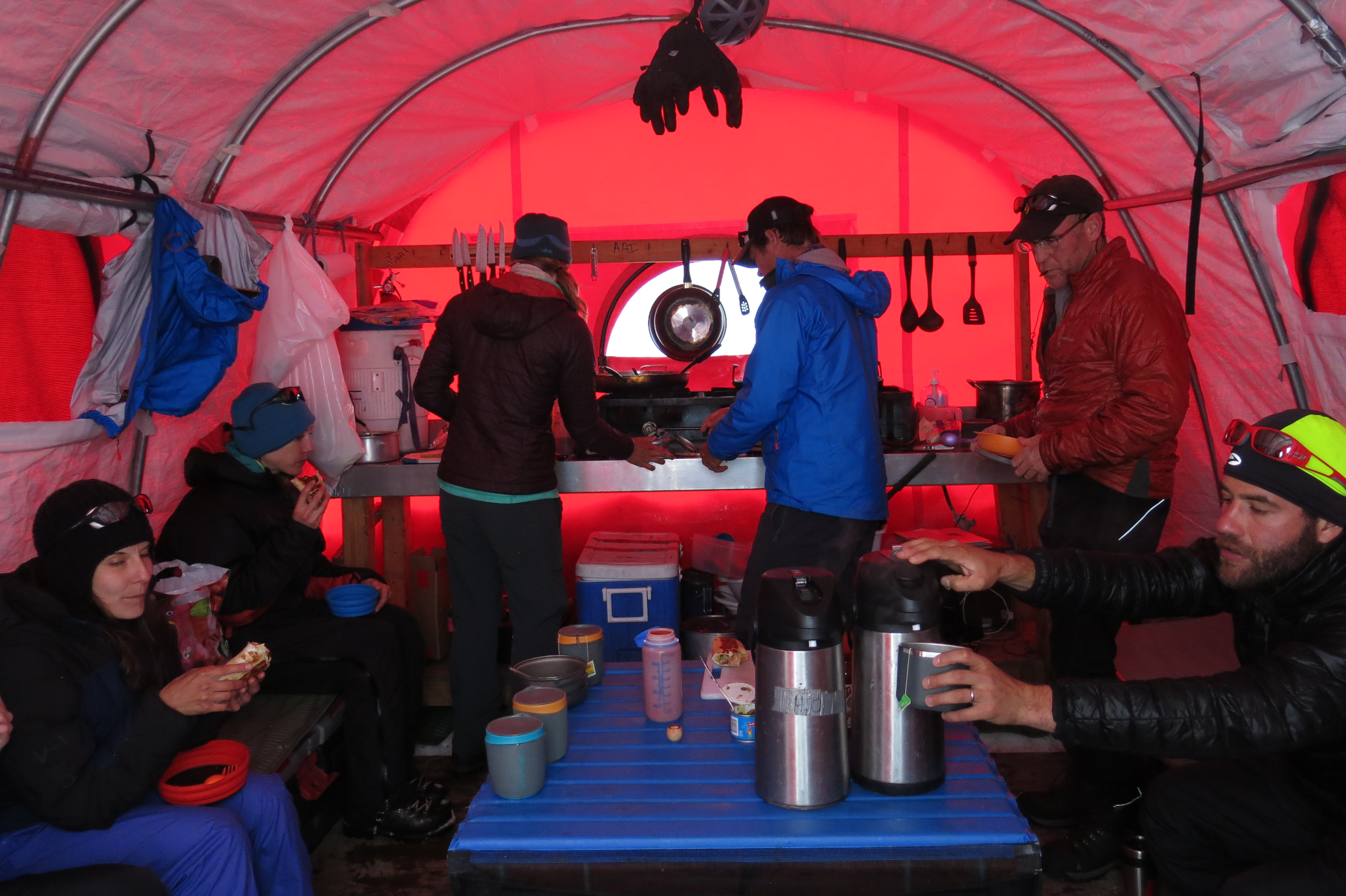
Self management is the key principle to enjoying mountaineering. That and physical fitness. At high elevation, you need to breathe right, eat thousands of calories and stay hydrated.

Hiking consists typically of 60 minutes of steady climbing followed by a short ten minute “rest” which is anything but relaxing. In the ten minutes you need to add jacket layers because it gets cold quick when you’re not moving and then force feed yourself a descent snack, drink at least 1/3-1/2 Liter of water, reapply sunscreen and make any equipment adjustments for the next 60 minute push.

We simulated this pace for the two warm up days as we took it easy skiing the lower slopes by day and slept through the 50 – 70 mph gusting wind in our tents at night. Our first night it dropped to a frigid -5 degrees F causing me to shiver in all my layers of clothes I brought with me. That night sucked.

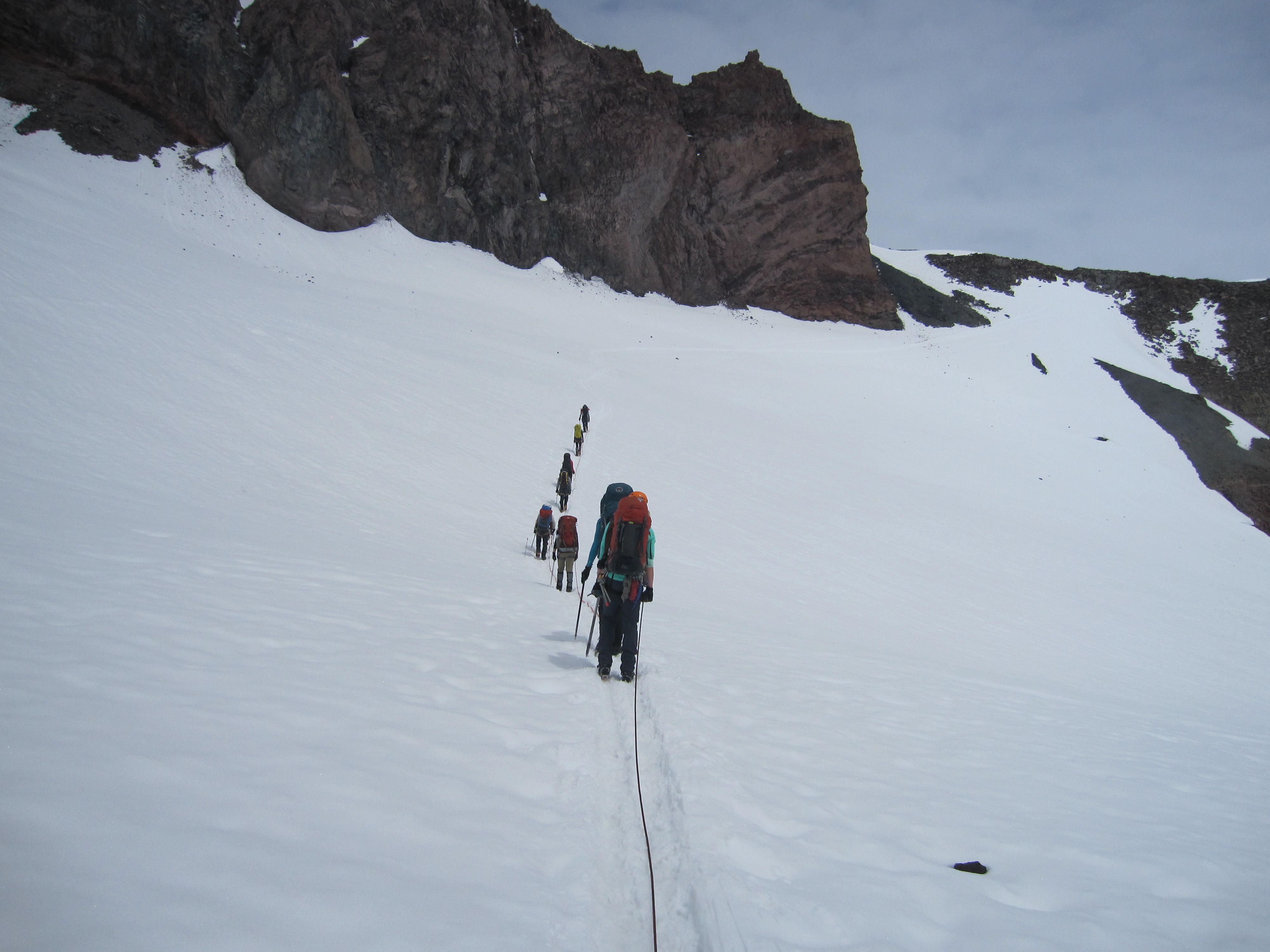
Summit night fortunately was not so oppressive. It was a pleasant 20 degrees when we embarked for the summit at 3am. We skinned as far as we could until the slope became too steep. Then, we attached the skis to our bags and we walked up the mountain roped together with crampons and ice axe.

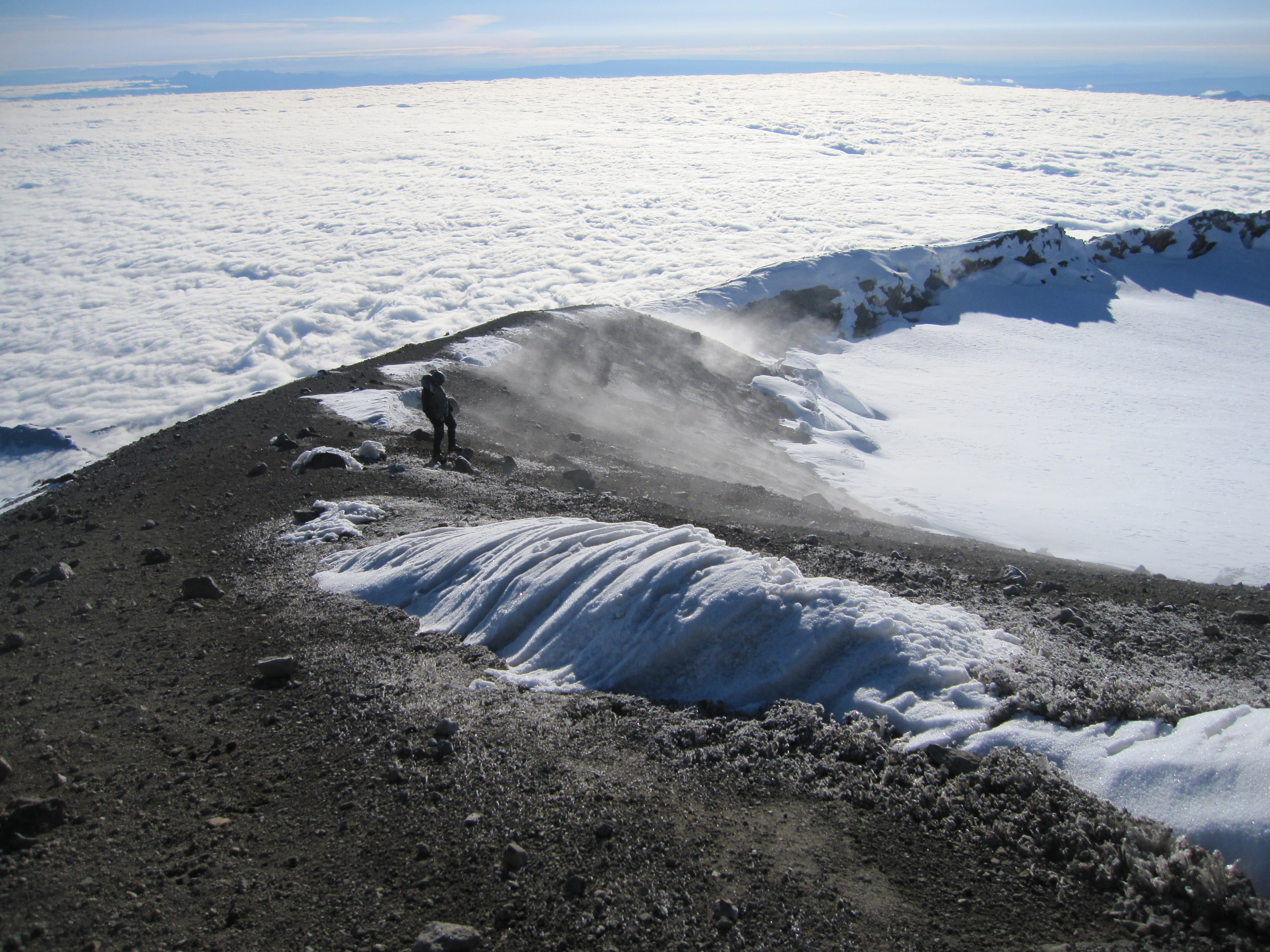
I felt we had perfect conditions. We were moving at a descent pace and were approaching the summit, until, 1000 feet from the top, the winds picked up. Roped together one of my co-clients kept slipping in the wind and we were preparing to self arrest to prevent a treacherous fall and slide down the face of Avalanche gulche.

We all moved quickly for cover under a boulder near a ridge but this provided us with little shelter. Unfortunately, this was the end of the line for us. It was determined too dangerous to continue when it was too difficult to hear each other shout at each other from 10 feet away.

We replaced our crampons with skis and proceed with down the icy scree on a power turn of shame.

My disappointment was fleeting. I was intently focused on not falling, because loosing my edge with any bit of speed will lead to a long painful slide down a 40 degree 2000 foot slope. My guide admitted it was one of the worst conditions he had ever experienced in 69 summit attempts.

It was a total shock to experience such extreme, windy, treacherous conditions in rapid moving cloud cover at 13,000 feet because at 10,000  feet, it was a spring skiing wonderland. Thigh burning razor sharp turns on crust, turned into ballet carving on the soft corn snow at the lower elevation.

Shasta does not go as one for the books as a summit, and I failed the Oklahoma couple and could not find the inter-dimensional beings.


A little advice when back country

I visited my brother January, 2016 who lives and works in Keystone Colorado. On our Vail ski day, we dabbled in a little backcountry skiing. We passed through the gaits to hunt for the freshest snow on the mountain.do not pass

What we found was a band of cliffs with no easy route of escape. I peered over the edge of a twenty foot drop and looked at my brother. We started discussing whether we should take our skis off and walk the other way.

All of a sudden, a lone skier came near us. He wore dreadlocks and smelled like weed and we hoped he knew the safest way down. Well, it turns out he did. “Just go off the cliff bro.”

“It’s only 20-30 feet into a foot of powder.”

He saw the fear in both of our faces.

“When my father took me when I was younger, he would say, throw off your skis, take a running start, jump and when you land on your back there will be nothing to worry about.”

For some reason it seemed like the right piece of advise I needed. I didn’t throw off my skis, but I backed up, thrusted forward to the cliff and jumped.

I did not come close to landing, but it was the softest wipe-out I could ever imagine.

after launching the cliff
selfie after crashing off of that 20 foot cliff behind me

Here are some other photos from the ski trip:

This slideshow requires JavaScript.

Mt. Ranier June 2015

I give infinite gratitude to my wife for letting me leave her and my nine month old daughter for a week to pursue a peak on my bucket list. I flew out to Seattle and joined Alpine Ascents for a guided tour of Mt. Ranier. We took a three day organized climb to reach the 14,411 foot summit. By elevation, Ranier ranks as the fifth tallest mountain in the lower 48 states, eighty four feet less than the tallest, which is Mt. Whitney. It is important to note however that Ranier is the most prominent peak by three thousand feet. Prominence refers to the distance from the lowest contour of the mountain to the highest point of the summit. It is massive and towers over Seattle.Mount_Rainier_over_Tacoma

Ranier is an active, glaciated volcano which requires preparation for volatility in the weather and terrain. Just like the George Martin Game of Thrones inspired novel series The Song of Fire and Ice, travel on the mountain exposes one to the extremes of contrasting conditions as blazing radiating sun is as much of a menace as frigid cold windy weather. Glacier travel sets it’s own unique set of obstacles. The safest means of travel requires foot crampons, an ice axe and walking roped to a team with a harness so if one accidentally falls into a crevasse, the rope can be taught and the team can save the poor soul from an icy and probably painful plummet into depths of up to 100 feet.

My tour group was a crew of seven solo adventurers, coming to Washington state from different parts of the country and world, with a healthy range of ages, careers and experiences. We first met our lead guide in downtown Seattle for the gear check and to get ready for 6am bus ride awaiting us the next day.

PANO_20150601_151915It was raining on Day 1. We took no time putting our hard-shell rain clothes in the parking lot for our snow hike up the mountain to Camp Muir base camp. This was a six hour fitness test that started at 5,000 feet elevation and ended at 10,000 feet to rest our tired shoulders from carrying 45 pound packs.

IMG_7805
7 clients, 4 Alpine Ascents guides ready to take on RAINier
IMG_4002
Getting our fill in the cook tent. Tonight will feature fresh made burritos. (I ate two and a half)

Day 2 was relaxed in the morning. We took a crash course in winter mountaineering where our guides gave a quick tutorial about up and down hill climbing with snow crampons, self arrest with an ice axe and roped travel. The lesson was brief and even though we may have wanted more teaching time, it did not take too long to find our comfort zone during the the hour and half trek across Cowlitz glacier to our second base camp on Ingraham flat at 11,000 feet elevation.

IMG_7816
The trick in roped travel is to keep good tension by staying 35 feet behind your partner at all times.
IMG_7822
Roped travel intends to save you in the rare chance that you or your partner meet a deep glacier crevasse.
IMG_4019
Our base camp overlooking Little Tahoma peak (third tallest in Washington)

After an early dinner, we tried in earnest to get some sleep before the 11pm wake-up call for the summit push. Our first test was a steep climb up snow and rock via Disappointment Cleaver (named because when the first team that ever used this route climbed to the top of the cleaver, they mistakenly thought that they had reached the summit). I should say this was really the second test, with the first being the process of packing and suiting up in the dark and cold.

IMG_4043
A waning gibbous moon (almost full) and clear skies brightened our climb through the night.
IMG_4044
Looking in the dark to start our trek on disappointment cleaver.

blogger-image--2059772852


Walking in the night through Ingraham glacier is simply surreal. I imagined that I was walking on the moon, navigating around massive craters and feeling like a speck; an insignificant particle in the backdrop of an utterly expansive universe. The climb required several leaps of faith over narrow snow bridges that were slowly fading into a creavasse. We moved quietly below avalanche potential snow fields and precarious above-hanging seracs and boulders. Eventually we were greeted by sunrise.

IMG_7839
Mt. Adams in the background (the second tallest mountain in Washington). Not pictured is an also visible Mt. Hood in Oregon from this view.
IMG_7876
The crater rim on top of Rainer. It looks like an infinity pool to the ocean of clouds.

The summit came in sight right about the time I lost feeling in my fingers due to the 14,000 feet of elevation cold. I started having severe bi-frontal headaches. It was tough to tell if this was Acute Mountain sickness or caffeine withdrawal. I tried treating both by breathing techniques and downing caffeine filled gummy chomps. It was just one foot in front of the other at a steady pace until we reached the summit at 6:30am.

I was able to warm up in the sun in the cone shaped crater rim at the top. The true summit required trudging across the 1,000 foot diameter snow field to gain a dozen feet to reach the high point. Rushing to the top was the most anaerobic I got during the climb and I feared that I was running out of gas just before the descent. Nevertheless, we made it to the top on a stellar visibility day.

Framer Ranier
It’s good to be on top. You can see from Oregon to Canada. Including Mount St. Helens and Mount Baker.
blogger-image--261104903
As a group we all made it to the summit. Statistically there is only a 50% success rate.

We had a 100% group success rate. Erin, one the fellow climbers had severe nausea and was dry heaving before we started, and to make matters worse she was celebrating her birthday. It was unclear if she would make it and many guides would have sent her back to base camp, but the Alpine Ascent team took great care of her, partnered her solo on a rope and paced themselves perfectly to make the summit around the time we did.

The summit celebration was sweet, but short. Most mountaineering accidents occur during the descent. Our lead guide Brent brought us together and spoke firmly about focus and moving quickly because a slow descent meant more time in the sun and a greater likelihood of “the wheels falling off.”

IMG_7883
Going up is harder than going down, but going down is way more dangerous .

We pulled together and hobbled to the Paradise parking lot at 2:10pm. Fourteen continuous hours of trekking left us thirsty for beer and we had our final little celebration at a spot in Ashton before taking the two hour drive back to Seattle.

Find Your Inner Moses

This essay is inspired by my run into the desert:

Moses was herding sheep in the desert when, likely as a result of malnutrition and dehydration, he had a vision of a burning bush. This was a hallucination, but it speaks to a reality like any archetypal metaphor, symbol or myth. The burning bush was a proof of the sacred- the benevolent flame kindling on the inside- and acted as motivation to dedicate Self to this presence. When Moses survived and his story spread in the historical tradition, he was deemed a prophet, a chosen vessel to dictate divine lessons to the masses. The masses are now his flock, encouraged to take his vision and message as law, because it is assumed that the patriarch carries greater clarity than the discoveries derived from Self.

In various Native American traditions (Navajo, Hopi), there is a juxtaposition of this philosophy. There are many Moses figures and he is not a patriarch, but an example to take a personal desert journey. The crucial rite of passage into maturity is the self-guided vision quest.  This occurs when a young man or woman enters into the isolation of the wilderness and is forced into a period of self deprivation with the intent on bringing about a personalized epiphany. If a transformative moment is reached, the vision quest is a success. In this tradition everyone is Moses, not just the destined selected prophets. In the Judeo-Christian tradition, the masses are Hebrews, followers of an unquestioned tract, just like the flock of sheep. We are encouraged to avoid the wilderness, engage in commerce and focus on civility.

For many, there is really not too much wrong with that.

Cultural traditions are based on cultural structures: a nomadic tribe will need strong individuals while a populated city requires a slightly diminished sense of Self to allow for an easier controlled community. Yet, we still have the biological make up of nomads. Even though we wear clothes, there are naked processes influencing our behavior and health. As a result, modern human holds the capacity to grow from the vision quest. This should not be a lost ritual in crowded times and it is important to find one’s inner Moses on the journey for self-actualization.

Desert Runner

I planned a 4 day running trip where I aimed to run 100 miles over five days in four different national parks, canyons and deserts.

While pushing my body in unforgiving, but inspiring landscapes, I learned to appreciate that deserts mean deprivation and in this state, the spirit learns freedom. The absence of the material necessities of life (WATER) provide nourishment for the imagination to go unfiltered. Yes, this may be a default mechanism of survival which is why mirages appear, but it brings appreciation for a sentiment that an influential circumcised carpenter held held when fasting in the wilderness. Jesus was tempted by the devil to use magical powers to satisfy his hunger and he responded, “Man shall not live on bread alone.” (Matthew 4:4). This famous biblical parable is a mythological archetype, one that faced Buddha and Moses as well. In the wilderness, when removed from the structures of survival, temptations for the temporal are easily blown away like winds pushing tumbleweeds along the eternal desert landscape.

Missy and I flew to Los Angeles to visit her brother, sister-in-law and their new baby. On the last day of the visit, I woke up early to start my adventure by running 10 miles in the city. I then dropped Missy at the airport, kissed her goodbye and started my 7-hour drive to Zion National park.  Arriving just before dark, I was able to find a free area to camp and set up tent on the side of the road right outside the park.

On top of Anels Landing (Zion Nat'l park)
On top of Anels Landing (Zion Nat’l park)

The next morning, I made arrangements with Zion Adventures company to get dropped off at Lava Point trailhead (in the middle of the park) and head off running on the 16 mile West rim trail. Even though I thought I was traveling on a relatively popular backcountry path, it took 9 miles before I saw my first human as I trotted along the canyon rim on undulating terrain. Eventually, I caught up with some crowds at Angels Landing, where I tested my patience while waiting on line to climb up the steep pathway to the top. Eventually, I ran back to the park entrance to my car totaling a 22 mile day.

From above the West Rim Trail (Zion National park)
The canyon seen from the West Rim Trail (Zion National park)
The Three Patriarchs (Zion natl park)
Bryce canyon at sunset

I then drove through the park and to Bryce Canyon and camped at the North Campground, setting up camp right next to the canyon edge. Before turning in for the night, I was able to catch the sun set over hoodoos shaped like melting golden hallucinations in a secluded spot just right off the Rim Trail.

The next morning, I first ran an 8 mile sunrise warm up on the Fairyland loop. I returned, packed up camp and eventually flagged down a free shuttle bus heading to furthest point south in the park at Rainbow point. I departed from the tour group (they must have thought I was a lunatic) and started jogging along the Under the Rim Trail. Prior to setting off, I talked to one of the Rangers and told him my intention to run this trail and he urged me to reconsider since it was hard treking and it typically took hikers several days to complete the back-country hike.  Despite his warning, I forged forward and was feeling great until 13 miles in, I lost track of the trail and found myself lost in the wilderness. It took me an hour of climbing around steep hillsides and shaky ground made more unstable by a recent forest fire, until I finally made my way on track. This really set me back in time and added a fair amount fatigue, but I finished the 22 mile trail by 4pm.  In total, I traveled 30 horizontal miles during the day, but I climbed a total of 7000 feet of ascent while running at 8000 feet altitude.

IMG_0302 IMG_0247

Feeling depleted and soar, I left Bryce and drove to the nearby town of Escalante where I somehow found Hole in the Rock Road and raced against the setting sun across the bumpy, unpaved road (in a small 2 wheel drive car) to find a camping spot.  A wind storm made very difficult the task of setting up my tent, but I was able to wrestle with the tarp despite my tired running legs, ate a hearty dinner and counted shooting stars before retiring to bed.

The next morning, I decided to try out a unique style of trail running. I packed my water, walked to the end of a nearby unmarked ATV trail and head 4 miles straight into the desert with GPS on hand. I was in the middle of nowhere, but I felt like I was everywhere.

IMG_0405
Grand Staircase at Escalante national Monument
IMG_0426
Peekaboo slot canyon

IMG_0437I returned to my car without danger and then followed signs to the Dry Fork trailhead and then on to Peekaboo, Spooky and Brimstone slot canyons. After a not so easy walk down, I climbed, squeezed and crawled through a jungle gym of smooth, narrow walls of cut out rock. My favorite climbing move had to be when I suspended myself between walls with my feet on one side and my hands on the other as I moved horizontally through parts impossible to walk. In total, I ran/hiked 13 miles during the day.

I then left the Escalante playground and eventually drove back to the highway and into California and arrived at the Mojave desert at night, where I set up camp right off of Cima road near the Teutonia peak trailhead.  At 2am, I was woken by coyotes howling at the full moon. When I opened my eyes, I could not believe how bright the desert appeared despite being dusk. The moon was a spotlight over the desert and I contemplated putting a sleep mask on in order to fall back to sleep.

IMG_0458
top of Teutonia peak, first place Mojave Marathon 5/2013

The next morning, as luck had it, I needed to run 26 miles ( a marathon!) to complete 100 miles in 5 days. So began my Mojave Marathon of one, which I split into 3 sections- a sunrise trail running warm up, a fast paced dash on the lonely paved Cima road and then a grand finale climb of Teutonia peak.

IMG_0448
Cima Road in Mojave desert

When I finished, I felt exhilarated! I also felt a little dirty. And by a little, I mean I was a walking cesspool of unwashed sweat and dust after five days of  desert running.  I needed a bath, but there was no water sources. So, I settled for the next best option: the ice in my Styrofoam cooler that chilled my nutrition and water was all melted. I took this out and dumped it on my head and with a little soap I was all clean, ready for my prom date.

That night I head back to LA (took a real shower) spent time with my niece Ava, sister-in-law Esther and then went out on a celebratory dinner with my brother-in-law Mike at 4 on 6, a legit sushi restaurant in Encino and we chowed  omakase style.