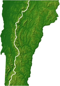
The Long Trail is a 273 mile hiking trail stretching the entire length of Vermont. In my final year of med school I thru hiked the entire trail in 20 days. I have attached my trip report bellow.

Long Trail Journal
Sam Grodofsky
July 7, 2009 – July 26, 2009
I have previously hiked on sections of the Long Trail. I grew up visiting Smuggler’s Notch Ski Resort in summers and winters and the lore of the hiking trail traveling through Vermont has always impressed upon me. In 2002, I hiked on sections of the trail around Mt. Mansfield and from Vt. 9 to the Southern Terminus and during this time I wondered if I could find the time and muster the courage to take on an End-to-End thru hike of the 273 mile monster.
Now that I am entering my fourth year of medical school, with the ability to take a month long vacation, I set forth to meet the challenge. Why am I doing this? I want to push my body to the limit, test my inner strength, enhance my wilderness survival skills and enjoy the beauty of Vermont. In the 20 days that it took to hike from Massachusetts to Canada over the green mountain range, I certainly met these challenges, but what I did not except is how much fun and joy that I would sustain over the length of the trail.
Day 1 Tue 7/7
County Road -> the woods ~5.0 miles South of Cogden shelter
Miles hiked (today)/(total): unknown (estimate 9.0 mi)/5.0
Start: 11:30am Finish: 6:30pm
My mom (in all her wonderfulness) drove me to County Road and dropped me off to begin my trek. After I kissed her goodbye, I set out onto the hiking trail- or at least so I thought. My excitement drove me forward ignoring the fact that I did not see any clearly marked white trail blazes or signs for about 45 minutes. Then, I heard what I hoped was a loud airplane echoing through the sky. This loud boom occurred again soon later, and I convinced myself that I was near an airport or air force base. Then a flash of light was visible in the horizon- maybe an airplane shooting a lazer beam? When the rain drops began and then picked up into a pour, I took a deep breath and set out into a heroic thunderstorm. I scrambled down the muddy trail, with little visibility feeling disoriented and wet. Lightening. Thunder. Mud. Mud Puddles. Loose footing. Disorientation. The rain died down, several hours later, and I began to feel relief. I took a deep breath of calm, turned a corner and noticed something oddly familiar. I returned to County Road! I walked in one long circle!
I scratched my head and decided to try it again, realizing that there were several forking trails veering off the one that I was on. After several hours (paying careful attention to go North), I reached a trail that just ended next to a pond with a large beaver dam. Then, raindrops. It was 6:30pm and another storm was about to hit. I set up my tent in a clearing (for the first time ever), placed all my food in a bear bag and hung it over a tree (for the first time ever) and tucked into my tiny one person tent as the raindrops beat down harder and harder. I later found out that during this storm, nearby there was significant hail damage and in upstate New York several tornadoes formed.
Day 2 Wed 7/8
The woods ~5.0 miles South of Cogden shelter -> the woods 2.0 miles South of Goddard shelter
Miles hiked (today)/(total): 17.0/22.4
Wake: 6:30am Start: 7:30am Finish: 6:45pm
When I awoke and placed on my soaking wet boots (a prominent occurrence for the next 20 days), after collecting my belongings, I looked around the pond. I consulted my Long Trail guide and map and became convinced that I was at Beaver pond. I decided to blaze through the overgrown ferns and brush, hiking shin deep in swampy mud and fording streams feeding the pond until I bushwacked up a hill and then I saw a wonderful site- a perfectly cut trail with white trail blazes. It became apparent that all day yesterday, I was never on the Long trail, but on ATV trails poaching the woods in a circuitous manner. I could not stop laughing at my stupidity.
I now faced the fact that I was 5.0 miles South from my intended starting place for the day (Cogden shelter) and became determined to hike 19 miles to Goddard shelter, near the peak of Glastonbury mountain to catch up to my itinerary. By mile 17, right before a significant climb to the top of the mountain, my legs could go no further, I set up tent again, with rain soon to come and spent another night in cramped conditions.
Day 3 Thu 7/9
The woods 2.0 miles South of Goddard shelter -> Black Brook (tent)
Miles hiked (today)/(total): 13.0/34.9
Wake: 7:30am Start: 8:30am Finish: 6:30pm
Well rested, but with a late start, I hiked up Glastonbury mountain and climbed a fire tower lookout providing an inspiring 360° view of Southern Vermont- my first scenic view of the trip so far. I trod through very muddy trails, crossed several extraordinary beaver dams (those rodents can really control water flow!). I knew I would not be able to hike Stratton mountain (my intended destination) so I decided to set up tent at a site next to the Black Brook bridge crossing. I was accompanied by a nice couple from Ashville, NC hiking with two dogs and we chatted the night away.
Day 4 Fri 7/10
Black Brook (tent) -> Spruce Peak Shelter
Miles hiked (today)/(total): 15.7/51.6
Wake: 5:30am Start: 7:20am Finish: 6:45pm
My left groin is killing me. I could not sleep last night because of the pain. After crawling out of the tent, I limped around setting up camp and made breakfast questioning how I was going to walk the anticipated 15.7 miles today and the over 220 miles left on the trail. I put on my heavy pack (which weighed about 50 pounds- a rookie error as I brought about 12 days of food) and started up Stratton mountain. I really lucked out as my groin loosened up and after the easy summit I was granted perfect bluebird skies and from the top of a fire lookout tower I was able to see the Adirondacks to the West, Berkshires to the South, White Mountains to the East and Killington to the North. The rest of the day was a 10 mile flat stroll across the woods, leading me to Prospect rock, exposed to the soothing sun and overlooking a deep cut valley. I made it to the shelter, for my first time avoiding my tent and slept soundly despite the frequent scattering of the resident mouse that thankfully did not take a rest on my face.
Day 5 Sat 7/11
Spruce Peak Shelter -> Peru Peak Shelter
Miles hiked (today)/(total): 12.9/64.5
Wake: 5:50am Start: 7:00am Finish: 3:30pm
I woke up dry as a bone, for the first time on the hike so far. I proceeded to hike Mt. Bromley, then Styles Peak and Peru peak before an easy descent to Peru Peak shelter at an early time. This was a well needed easy day on my groin, but as I returned to the shelter I focused my energies on nursing large blisters on both heels and both little toes. My early finish was extremely beneficial as around 7pm, a heavy rain and thunder storm started and the shelter quickly filled to capacity and we had to turn away a group of three hikers to suffer the night in the rain.
In the crowded lean-to, I met Mary Ellen, an extremely nice thru-hiker from Maine who would I would be an influential change in my trip down the trail.
Day 6 Sun 7/12
Peru Peak Shelter -> Greenwall Shelter
Miles hiked (today)/(total): 14.5 /79.0
Wake: 6:10am Start: 7:45am Finish: 5:30pm
I hiked past Little Rock Pond, which I wish I took a refreshing dip, but decided to progress on through the awful muddy trail and poor footing until the trail got nicer in the spruce forest of White Rock Mountain. On the mountain summit, before the scenic trail to an incredible view, many hikers over a 50 yard area created these elaborate, abstract sculptures by piling up the chalk colored rocks in an impressive manner. I then descended to Greenwall shelter to sleep in a comfortably populated shelter compared to the mess from the previous night.
I brought very interesting food to eat for the trip. Breakfast: oatmeal and goji berries, Lunch: trail mix, granola and clif bars, Dinner: quinoa, walnuts, almonds and curry powder.
Day 7 Mon 7/13
Greenwall Shelter -> Cooper Lodge
Miles hiked (today)/(total): 19.2 /94.9
Wake: 5:30am Start: 6:00am Finish: 7:30pm
This was the longest day of the trip. I woke up early and left quite rapidly from the shelter making good progress past Minerva Hinchey shelter, passing a nice overlook of an airport, then after descending to sea level, I started up a steep 1200 foot climb which rewarded me with no view. At mile 15, the blisters on my feet were becoming so painful and my plantar fascia so soar, that I considered staying at the unsavory Governor Clermont shelter at the base of Killington. I got pumped up and convinced myself to fight through the pain and muddy trails and trekked up the 4 mile, 2500 foot climb to the top of Killington. It seemed like the trail would never end and as I reach the summit of Little Killington at 6:40pm, I peered across to the big Killington peak over a mile away which was certainly the most discouraging view of the trip. Running on fumes I hiked the ridgeline and finally arrived at the cold, empty, lonely Cooper Lodge and spent the night ignoring the plastic windows flapping in the wind and clutching my aching body in my sleeping bag to keep warm. What a day!
Day 8 Tue 7/14
Cooper Lodge -> Inn at the Long Trail
Miles hiked (today)/(total): 7.3 /104.2
Wake: 5:20am Start: 7:00am Finish: 11:30am
Today was a great day. I woke up early to hike up the 0.2 mile trail to Killington summit to watch the sunrise. Unfortunately, the clouds restricted my view but at moments they would unveil the fertile Vermont green mountains. I descended 6 miles to route 4 near Pico Peak and then walked a mile on the road East to the Inn at Long Trail. This cozy, country, homey, warm, hokey inn was a hiker’s haven and the Irish pub connected to the inn provided a devastatingly tasty lunch (Guinness stew!!), dinner (Sheppard’s pie!!) and breakfast (buttermilk blueberry pancakes!!). Other than eating like a ravenous wolf chowing down a grizzly bear, I took the bus into downtown Rutland to mail some unnecessary items home and pick up some essential items that I neglected to bring. At the end of the day, showered, dry and well fed, I sunk into my soft Queen’s sized bed.
Day 9 Wed 7/15
Inn at the Long Trail -> David Logan Shelter
Miles hiked (today)/(total): 12.9 /116.9
Wake: 6:50am Start: 9:30am Finish: 5:00pm
Refreshed, re-energized, with a smaller load to carry, a belly full of pancakes, a clean pair of clothes and bone dry boots I hit the trail for an easy up and down 13 mile hike to the David Logan Shelter. Who knew what one day of rest could do to embolden the trip.
Day 10 Thu 7/16
David Logan Shelter -> Mt. Worth Lodge
Miles hiked (today)/(total): 16.5 /133.0
Wake: 7:30am Start: 8:20am Finish: 6:00pm
I woke up to rain drops coming down on the shelter, so I made the most reasonable response- I went back to sleep. Getting a later start than I planned, I hiked up Mt. Carmel and ran along the muddy ridgeline to beat a quick rain storm with a little break in Sunrise shelter. The rain let up and I passed the Brandon gap, climbed Mt. Horrid and finally to the top of Mt. Worth Lodge in Middlebury’s private ski hill. I had the spacious cabin to myself. I tried building a fire, but the wood was too soggy, so instead I brought a chair from the shelter to a ski trail to watch the sun set on the horizon. Time rarely stands this still and moments rarely glow as they do during a sunset.
Day 11 Fri 7/17
Mt. Worth Lodge -> Cooley Glen Shelter
Miles hiked (today)/(total): 13.6/146.0
Wake: 5:20am Start: 6:15am Finish: 3:50pm
I woke up early to watch the sun rise, quickly packed my bag and began walking on the ski trail trying to follow the trail. For the life of me, I could not figure out where to go. I decided to walk on a ski trail down the mountain which proved unwise. The waist high grass was soaking wet and made my boots completely drenched. Also on two large slippery boulders I lost my footing and slipped dramatically onto the rock face. I soon reached the bottom and looking at the map, I needed to follow VT 125 back to the trailhead and pushed onward- up Mt. Fordyce, the steep steps of Breadloaf Mountain and pleasantly along the ridge and settled in Cooley Glen shelter.
Day 12 Sat 7/18
Cooley Glen Shelter -> Stark’s Nest
Miles hiked (today)/(total): 13.8 /150.4
Wake: 9:00am Start: 10:00am Finish: 6:00pm
The rain woke me up, but I refused to let it keep me up and I ended up snoozing to make a very late start to the day. The misty morning cleared, giving way to the most beautiful views of the entire trip. I passed Sunset ledge and Mt. Grant admiring the stretches of pristine farming pastures. Next a steep crawl over the tree line to the peak of Mt. Abraham allowed me to take pride in looking over the Green Mountain peaks that I conquered over the past couple of days. Then I head on to Mt. Lincoln and Mt. Ellen, which brought back memories of the excellent terrain of Sugarbush. Just when I thought the excitement was over, I reached Stark’s nest ski warming hut on top of the Mad River Glen ski resort. The clear skies allowed an epic view of the lake Champlain and the Adirondacks that was simply breathtaking and I was able to watch the sun set into a cloudbank. I shared this shelter with a group of four hikers- Mary Ellen (who I met earlier) and three hikers who were accompanying her for her trek- Mat, Frank and Charles. We joked around at night as the sky produced the clearest starlight I have seen in some time.
Day 13 Sun 7/19
Stark’s Nest -> Bamforth Ridge Shelter
Miles hiked (today)/(total): 18.5 /178.9
Wake: 5:45am Start: 7:00am Finish: 8:30pm
Today marks a turning point in the trip. I left earlier than the other group (Mary Ellen, Frank, Mats and Charles), but after slow going down the mountain, they quickly caught up to me after crossing the Appalachian gap and were accompanied by two other hikers- Sue and Arm. I asked to join them and they agreed- on the condition that I go at their pace, which was blistering. They zoomed up Molly Stark mountain, Burnt Rock mountain and Mt. Ethan Allen, all providing expansive views, but they paled into comparison to the summit view from Camel’s hump which required a suffocating and steep ascent up menacing rocks. It was 6:00pm, we had climbed over 9000 feet in 14 miles and to celebrate, we drank some Sierra Nevada beers and chocolate chip oatmeal cookies brought by Arm and after enjoying our view from ontop of the world, we said goodbye to Sue, Arm and Mats and raced the setting sun 4 miles to the Bamforth Ridge shelter, which could not come soon enough. This was by far the most challenging and rewarding day so far. The trail was tough and the climbs would never end. But, it marked the beginning of a great friendship as I would hike the rest of the trail with Frank and Mary Ellen as we were all Canada bound. My knees, legs, feet, back all hurt. I was so stiff. What a tough day, what a beautiful world, what a wonderful life. Joy. Joy. Joy.
Day 14 Mon 7/20
Bamforth Ridge Shelter -> Duck Brook Shelter
Miles hiked (today)/(total): 7.6 /186.5
Wake: 5:40am Start: 7:15am (break 11am-3pm) Finish: 4:30pm
After a tough day, Mary-Ellen, Frank, Charles and I hiked to the Jonesville post office (where they re-supplied) and then we flagged down a cab to ride to Richmond, VT to eat (feast?) at a restaurant called the Bakery where we scarfed down 3 large pizzas between the four of us and I had my fair share of beers as we soaked in the sun next to the garden and park adjacent to the wonderful restaurant/cafe/bakery. I re-supplied at a local store and mailed food North to Johnson, Vt. Eventually their friend Andy picked us up and returned us to the trail head where we walked to the Duck Brook shelter and we located a nice little streambed to wash off in the scrotum tightening but refreshing water. This was a needed day of ease, fun, food and beer. Charles left us and I was now with Mary Ellen and Frank, ready to march on North.
Day 15 Tue 7/21
Duck Brook Shelter -> Butler Shelter
Miles hiked (today)/(total): 16.5 /203.0
Wake: 5:30am Start: 6:30am Finish: 5:30pm
Today felt like a hangover. I felt sluggish from beginning to end and with the exception of a nice view of Bolton mountain and Bolton Valley ski resort there was little scenery or excitement. At the end of the day, the rain started and we came half way up Mount Mansfield to stay in Butler Shelter.
Day 16 Wed 7/22
Butler Shelter -> Bear Hollow Shelter
Miles hiked (today)/(total): 16.1 /219.1
Wake: 5:50am Start: 7:30am Finish: 7:15pm
We woke up to a misty mountain. The sky did not yield rain but a persistent cloudy condensation. While the summit of Mansfield did not offer the views that I had hope due to the clouds, these interesting conditions were just as nice. The scramble to the forehead of Mansfield was challenging at many parts, downright treacherous at others (I was forced to take off my pack and shimmy across a rock hanging over a plunge to certain death if I slipped). On the summit, we stopped into the visitor’s center for some chocolate and then climbed to the top of the forehead of Mansfield before taking a difficult descent down the adam’s apple before traversing down to the Notch. Growing up, I spent my summers and winters in Smuggler’s Notch, so heading up Spruce peak, passing Stratton Pond and up Madonna Mountain brought much nostalgia. By the end of the day, we were exhausted, and after sauntering up Whiteface mountain we struggled down to Bear hollow shelter. We shared the shelter with 10 campers from an overnight camp in upstate New York. While it was crowded, the kids were quite pleasant and respectful.
Day 17 Thu 7/23
Bear Hollow Shelter -> Corliss Camp
Miles hiked (today)/(total): 17.9 (15.3mi LT, 2.6 mi to Johnson) /234.4
Wake: 5:10am Start: 6:00am Finish: 4:50pm
We woke up early and quietly without waking the campers walked to Rt. 15 to make our way to Johnson. Unable to hitchhike, we walked 2.6 miles to downtown and re-supplied at the post office from food I shipped to myself from Jonesville. We then stopped at a supermarket to pick up some boxes of wine and found a nice man to drive us back to the trailhead in his truck. For the rest of the day, it was easy going and we arrived to the shelter that we had to ourselves quite early. We downed the wine, pigged out on chocolate, oreos and built a pretty hefty camp fire as we celebrating our close proximity to Canada.
Day 18 Fri 7/24
Corliss Camp -> Tillloston Camp
Miles hiked (today)/(total): 15.0 / 249.4
Wake: 6:15am Start: 8:00am Finish: 4:30pm
Today was a straightforward day. Starting out I felt sluggish from the previous night’s fun, but other than a tough maneuvering down Devil’s gulch, we made it to the shelter, waiting for Mats and Frank’s wife Jess to join us at the shelter. They got in very late and had to hike in the dark to meet us at 11:30pm. Mats carried in two large pizzas and a full Heineken mini keg to continue our celebration.
Day 19 Sat 7/25
Tillloston Camp -> Jay Camp
Miles hiked (today)/(total): 11.7 / 260.9
Wake: 8:10am Start: 9:45am Finish: 6:30pm
We had a late start after a late night. We sluggishly climbed Mt. Haystack and gradually picked up our pace over Bruce Peak and Buchanan mountain gaining nice views of Jay Peak before settling into the dingy shelter at Jay Camp. In the camp, during dinner, Mats brought out another surprise- a bottle of champagne. The bubbles were well welcome, but the dirt and grime was getting a little old and I slept that night happy that it would be my last night on the trail.
Day 20 Sun 7/26
Jay Camp -> Journey’s End (Northern terminus)!!!
Miles hiked (today)/(total): 13.3 / 273
Wake: 5:45am Start: 7:15am Finish: 3:30pm
Our last day began with rain- appropriate conditions for the soggy hike. We climbed the interesting, rocky summit of Jay Peak (no views) and then picked up the pace over several rolling summits as we reached the Northern Terminus and Canada. I made sure that I crossed the final marker with Mary Ellen culminating my 272 mile trek across Vermont. Massachusets to Canada. Complete!


 portions of the mountain and then lock in our heals and alpine ski down in the soft warmed up corn snow. Turns just feel like you are spreading butter on a fresh baked bread.


 I used to be in great shape. I’ve completed several 50 mile ultra-marathons, Ironman triathalons and was constantly training for my next endurance event. For each race, I spent months rigorously adherent to a strict schedule. Races are easy if you train hard. My philosophy was on the competition day to just wake up to the alarm and respect my fitness.
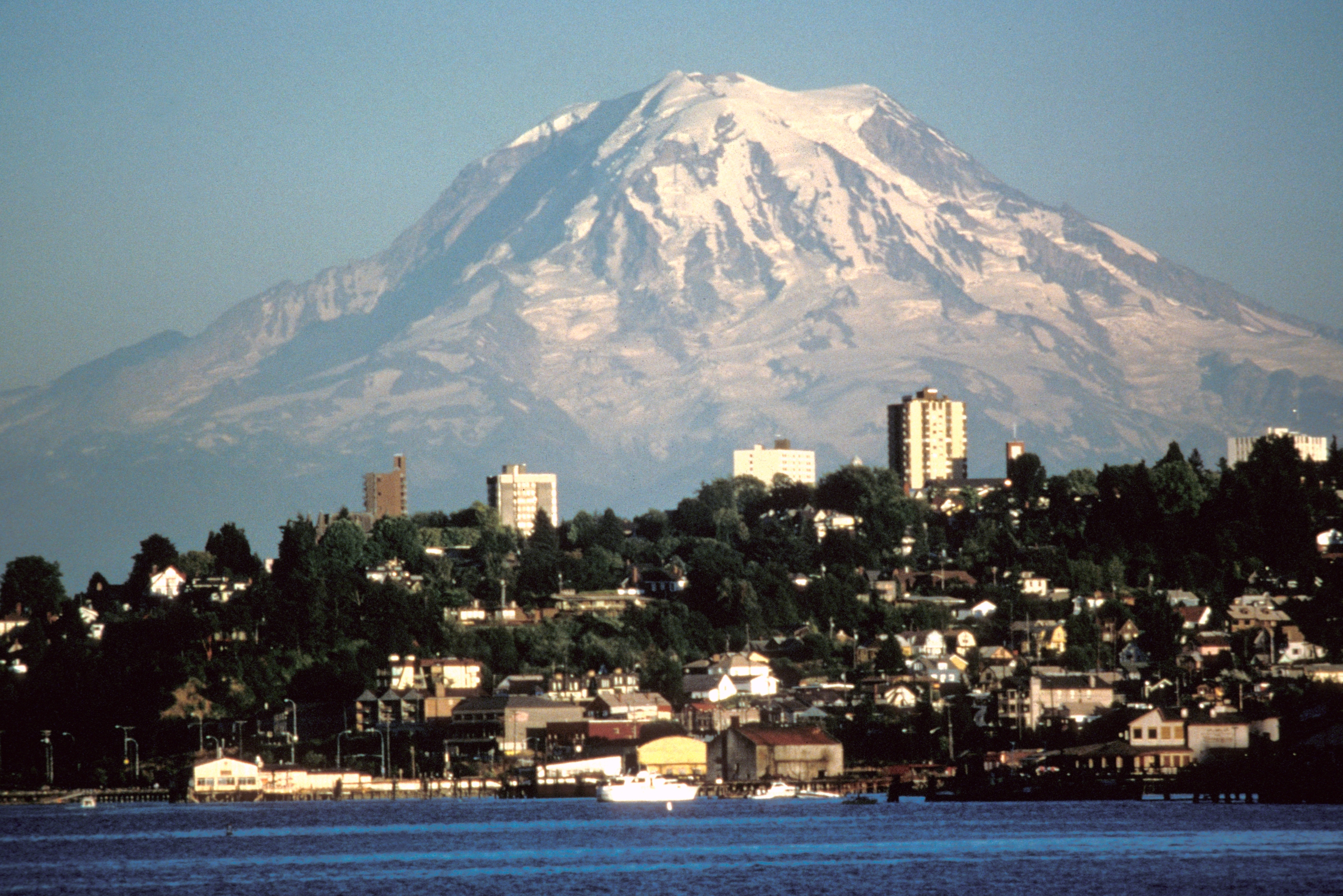

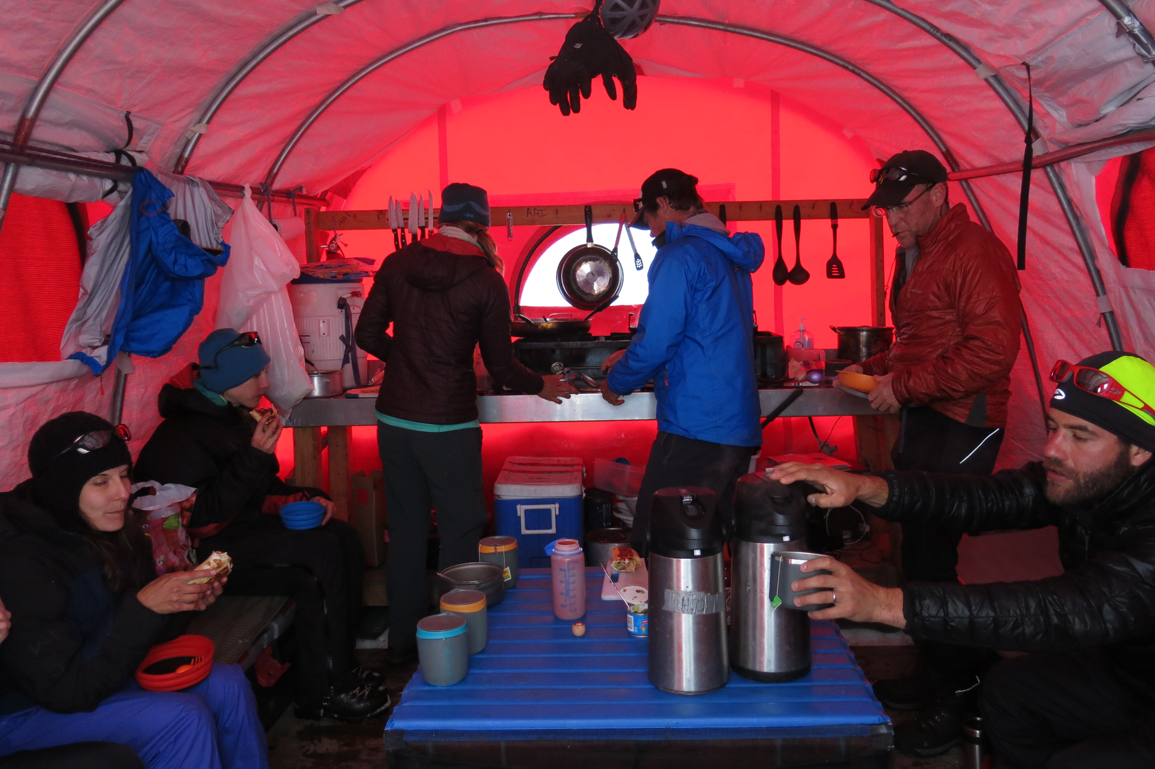
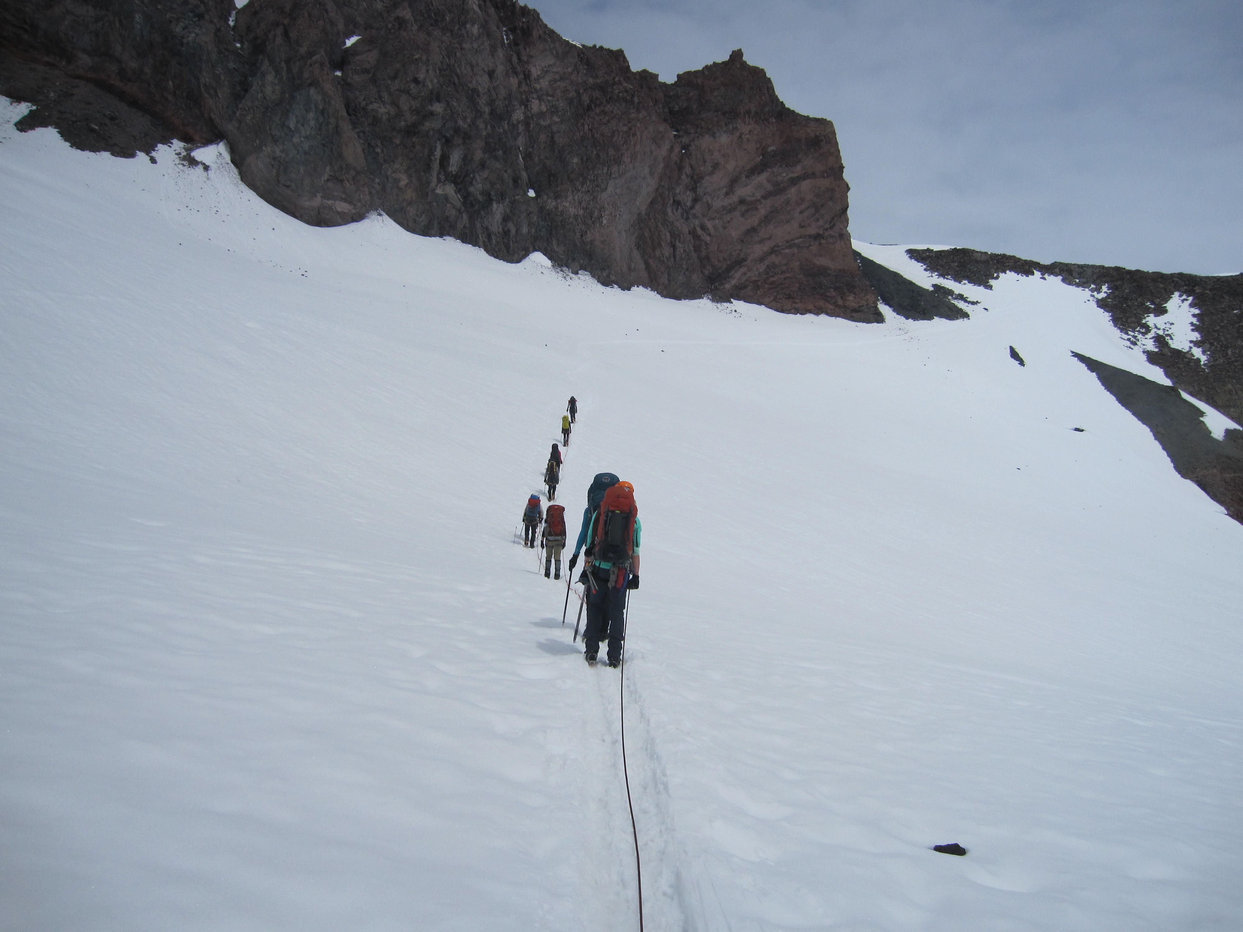


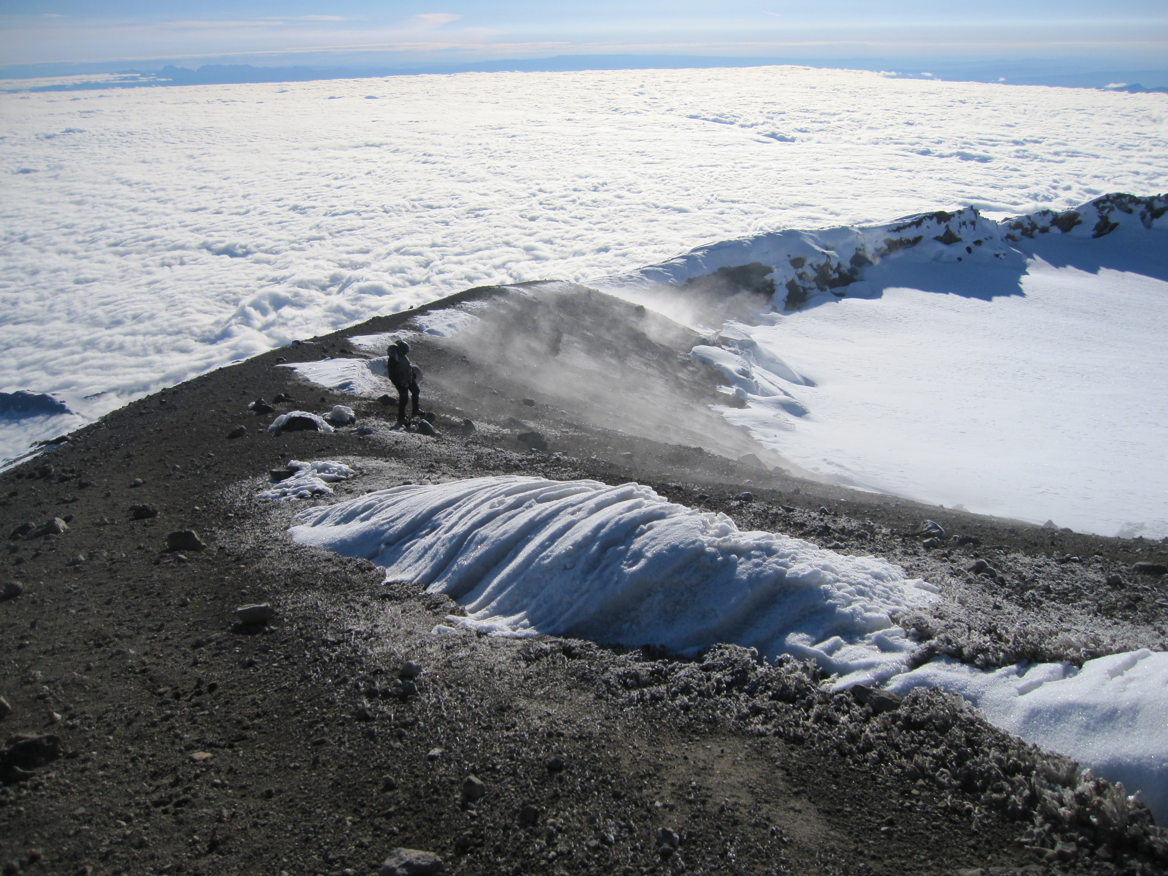


 To help get in shape for my Mt. Ranier climb, I traveled on my weekend off to the Presidential Range in April to test out my newly purchased ice axe and crampons.