
I give infinite gratitude to my wife for letting me leave her and my nine month old daughter for a week to pursue a peak on my bucket list. I flew out to Seattle and joined Alpine Ascents for a guided tour of Mt. Ranier. We took a three day organized climb to reach the 14,411 foot summit. By elevation, Ranier ranks as the fifth tallest mountain in the lower 48 states, eighty four feet less than the tallest, which is Mt. Whitney. It is important to note however that Ranier is the most prominent peak by three thousand feet. Prominence refers to the distance from the lowest contour of the mountain to the highest point of the summit. It is massive and towers over Seattle.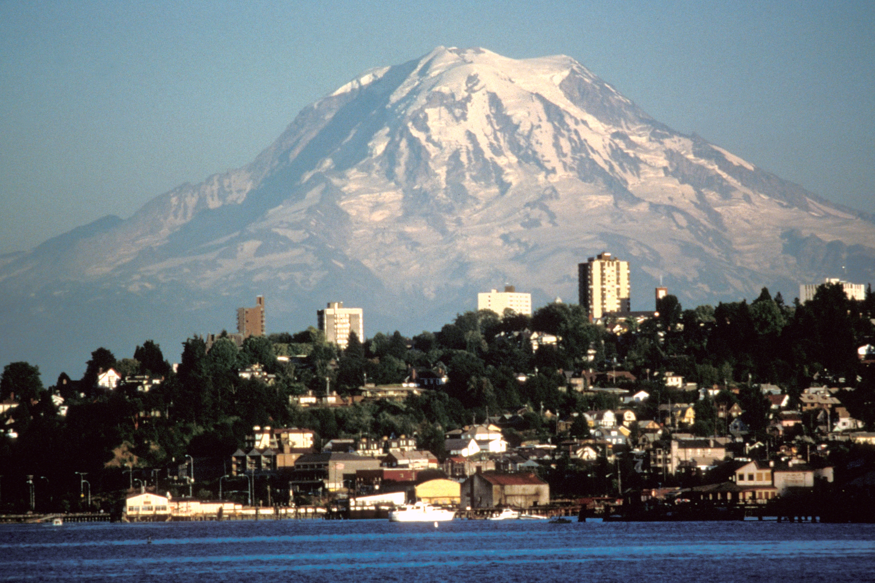
Ranier is an active, glaciated volcano which requires preparation for volatility in the weather and terrain. Just like the George Martin Game of Thrones inspired novel series The Song of Fire and Ice, travel on the mountain exposes one to the extremes of contrasting conditions as blazing radiating sun is as much of a menace as frigid cold windy weather. Glacier travel sets it’s own unique set of obstacles. The safest means of travel requires foot crampons, an ice axe and walking roped to a team with a harness so if one accidentally falls into a crevasse, the rope can be taught and the team can save the poor soul from an icy and probably painful plummet into depths of up to 100 feet.
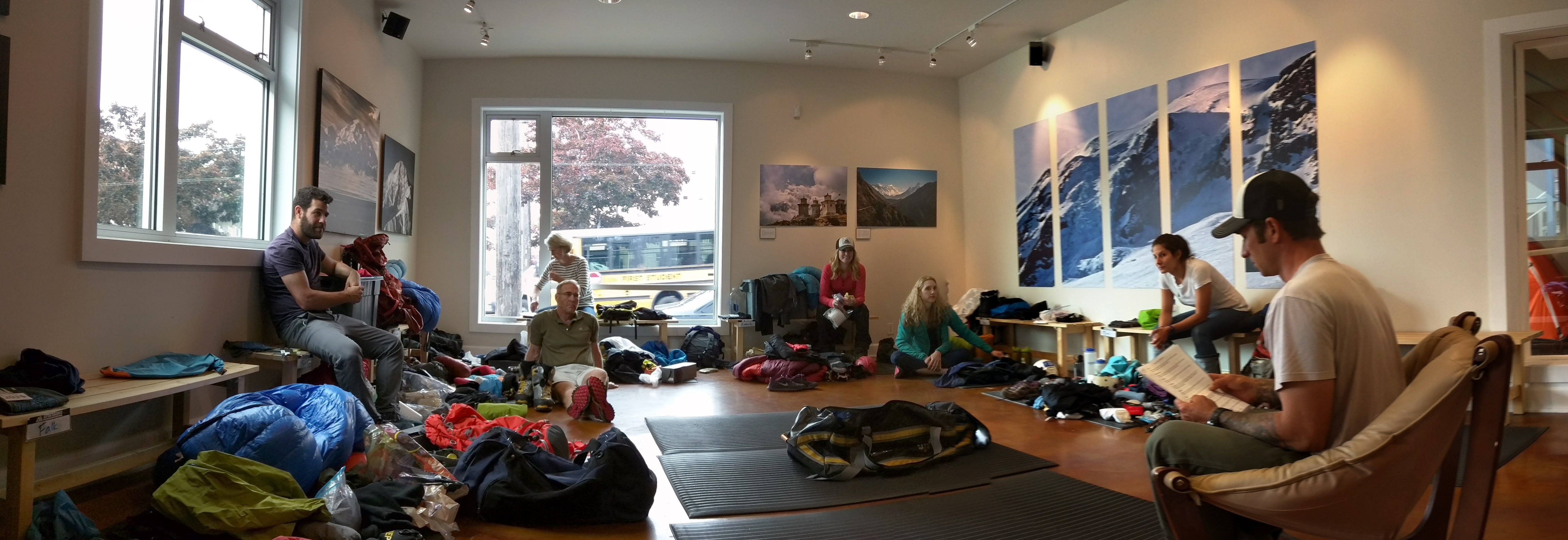
My tour group was a crew of seven solo adventurers, coming to Washington state from different parts of the country and world, with a healthy range of ages, careers and experiences. We first met our lead guide in downtown Seattle for the gear check and to get ready for 6am bus ride awaiting us the next day.
 It was raining on Day 1. We took no time putting our hard-shell rain clothes in the parking lot for our snow hike up the mountain to Camp Muir base camp. This was a six hour fitness test that started at 5,000 feet elevation and ended at 10,000 feet to rest our tired shoulders from carrying 45 pound packs.

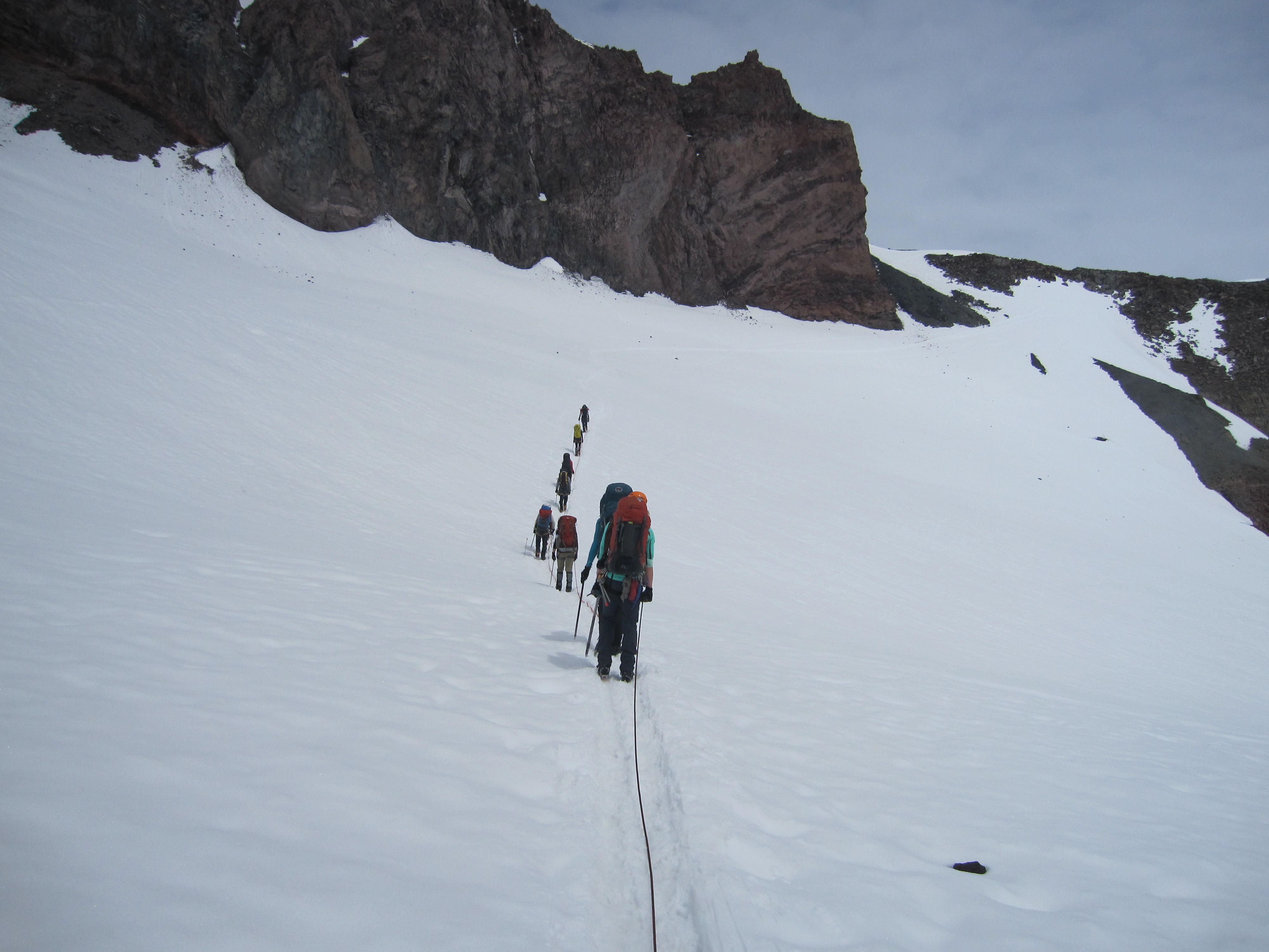
Day 2 was relaxed in the morning. We took a crash course in winter mountaineering where our guides gave a quick tutorial about up and down hill climbing with snow crampons, self arrest with an ice axe and roped travel. The lesson was brief and even though we may have wanted more teaching time, it did not take too long to find our comfort zone during the the hour and half trek across Cowlitz glacier to our second base camp on Ingraham flat at 11,000 feet elevation.


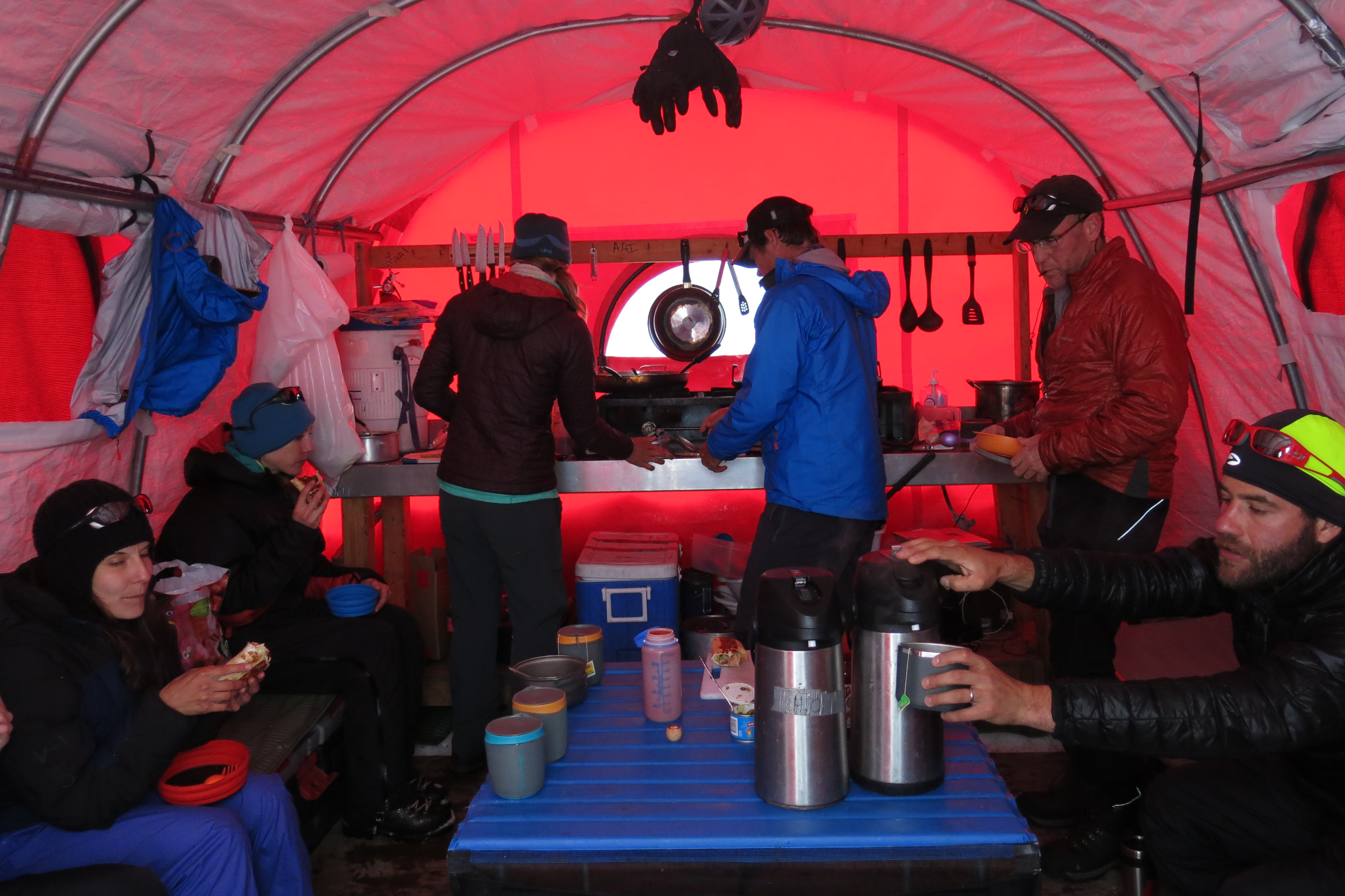
After an early dinner, we tried in earnest to get some sleep before the 11pm wake-up call for the summit push. Our first test was a steep climb up snow and rock via Disappointment Cleaver (named because when the first team that ever used this route climbed to the top of the cleaver, they mistakenly thought that they had reached the summit). I should say this was really the second test, with the first being the process of packing and suiting up in the dark and cold.


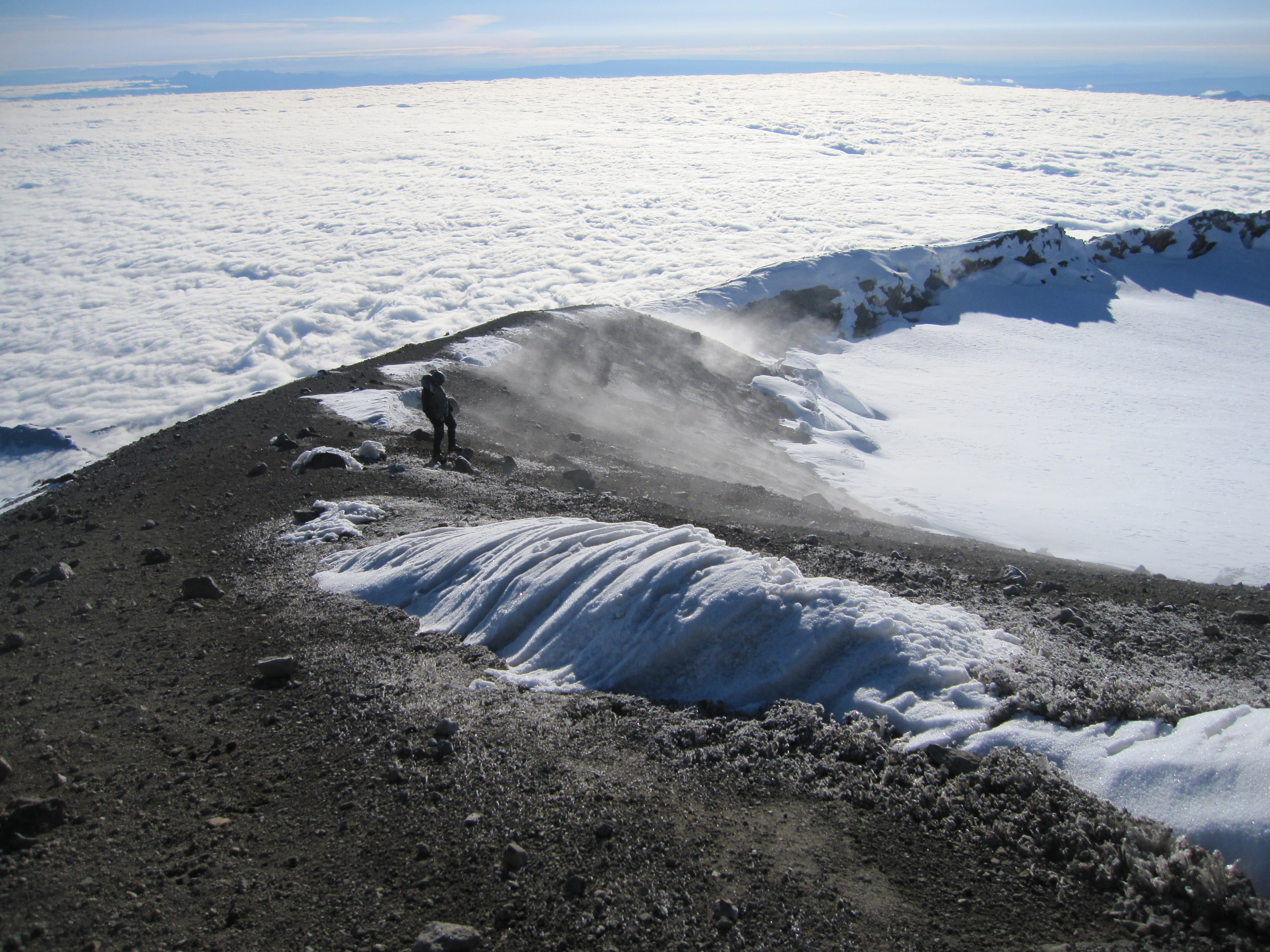
Walking in the night through Ingraham glacier is simply surreal. I imagined that I was walking on the moon, navigating around massive craters and feeling like a speck; an insignificant particle in the backdrop of an utterly expansive universe. The climb required several leaps of faith over narrow snow bridges that were slowly fading into a creavasse. We moved quietly below avalanche potential snow fields and precarious above-hanging seracs and boulders. Eventually we were greeted by sunrise.


The summit came in sight right about the time I lost feeling in my fingers due to the 14,000 feet of elevation cold. I started having severe bi-frontal headaches. It was tough to tell if this was Acute Mountain sickness or caffeine withdrawal. I tried treating both by breathing techniques and downing caffeine filled gummy chomps. It was just one foot in front of the other at a steady pace until we reached the summit at 6:30am.
I was able to warm up in the sun in the cone shaped crater rim at the top. The true summit required trudging across the 1,000 foot diameter snow field to gain a dozen feet to reach the high point. Rushing to the top was the most anaerobic I got during the climb and I feared that I was running out of gas just before the descent. Nevertheless, we made it to the top on a stellar visibility day.
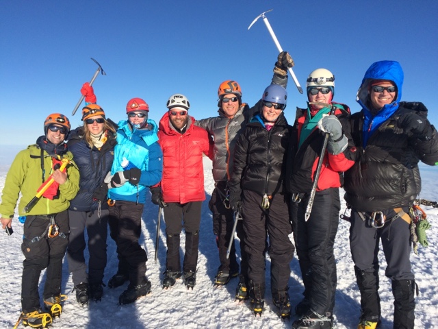
We had a 100% group success rate. Erin, one the fellow climbers had severe nausea and was dry heaving before we started, and to make matters worse she was celebrating her birthday. It was unclear if she would make it and many guides would have sent her back to base camp, but the Alpine Ascent team took great care of her, partnered her solo on a rope and paced themselves perfectly to make the summit around the time we did.
The summit celebration was sweet, but short. Most mountaineering accidents occur during the descent. Our lead guide Brent brought us together and spoke firmly about focus and moving quickly because a slow descent meant more time in the sun and a greater likelihood of “the wheels falling off.”

We pulled together and hobbled to the Paradise parking lot at 2:10pm. Fourteen continuous hours of trekking left us thirsty for beer and we had our final little celebration at a spot in Ashton before taking the two hour drive back to Seattle.
